Solutions
GIS Services
Benefits:
- Develop maps that illustrate development patterns within a jurisdiction
- Issue letters to all properties within a defined radius of a proposed zoning variance
- Quickly generate reports based upon geospatial selection of locations
- Check whether an address or area falls in a special district or subject to special condition
BluePrince’s bidirectional Geographic Information Systems (GIS) integration allows development departments to tap into the jurisdiction’s existing GIS system for a comprehensive geospatial view of building data.
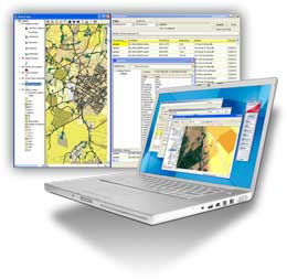
GIS Maps within BluePrince
BluePrince users have the ability to display existing GIS maps within BluePrince. By specifying the desired GIS layers, individual users can view only the information they need. For example, plan reviewers can see zoning, proximity, sensitive ecology, and other overlays on the same form as their plan review checklist.
BluePrince Data within GIS Maps
Users can view all projects, properties, permits, and inspections as a layer within a GIS data. This information can be combined with external GIS data to build powerful views and queries. These queries include real-time checks of whether an address is in a special district or subject to any special conditions. Development data adds extensive information to community maps, by spatially showing building trends by type (commercial or residential) and valuation.
 Related Topics: Planning and Zoning, Permits and Inspections, Offline Interface.